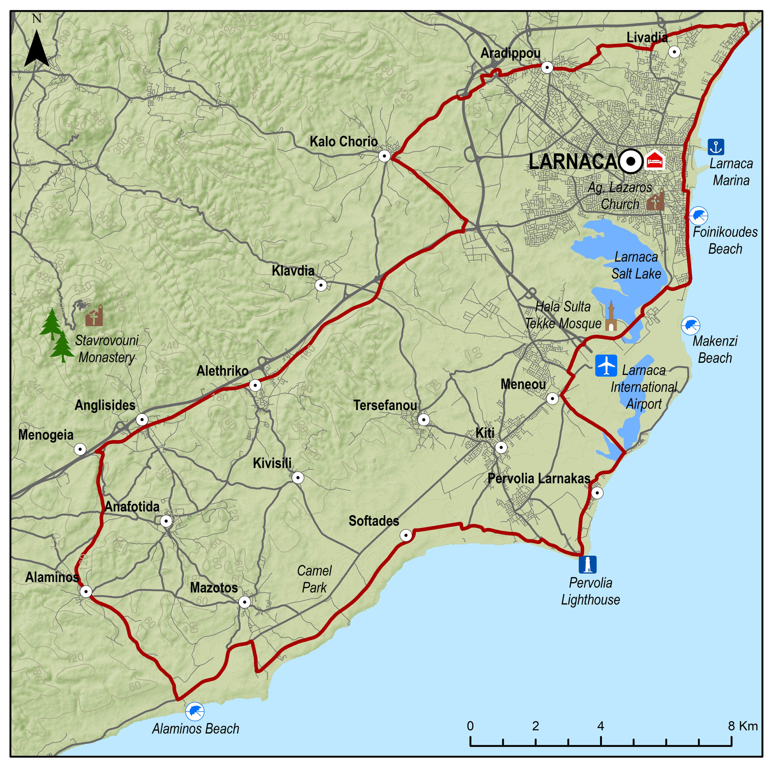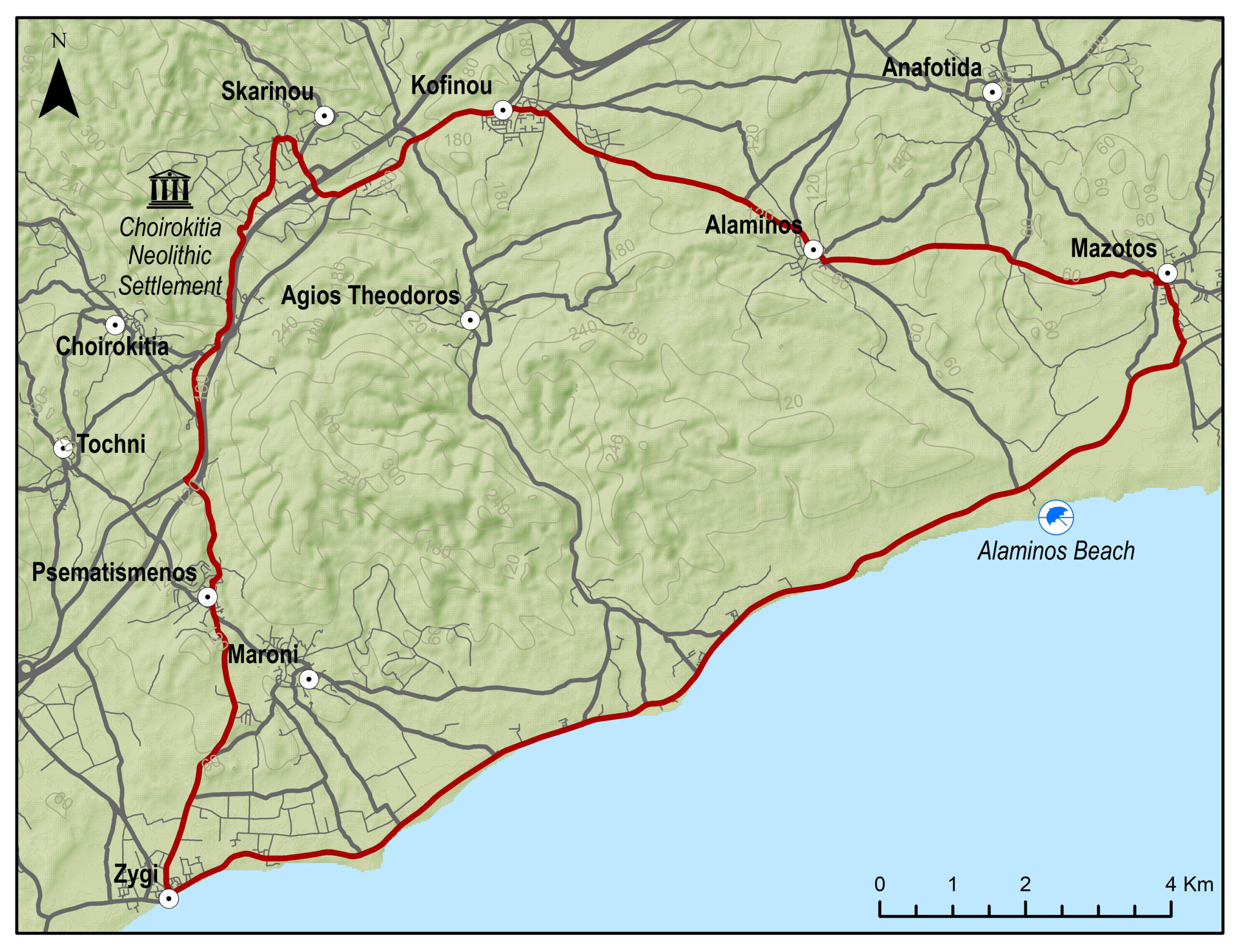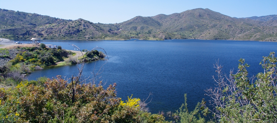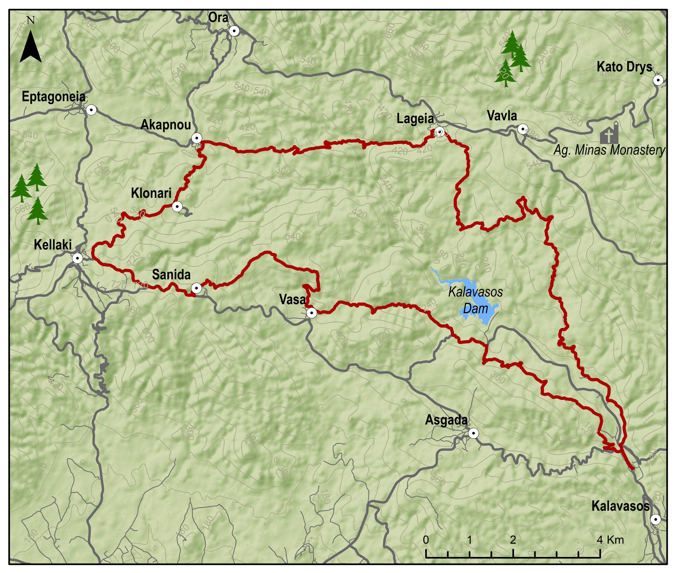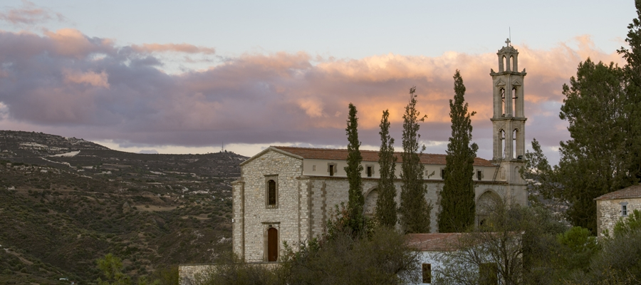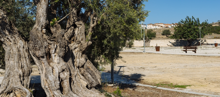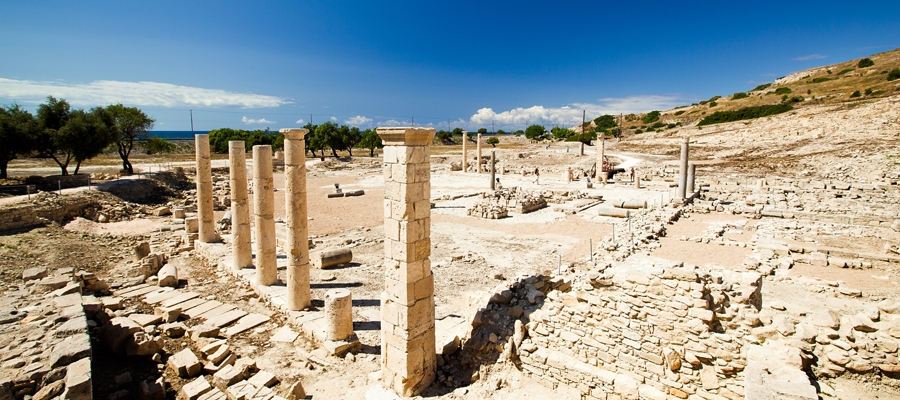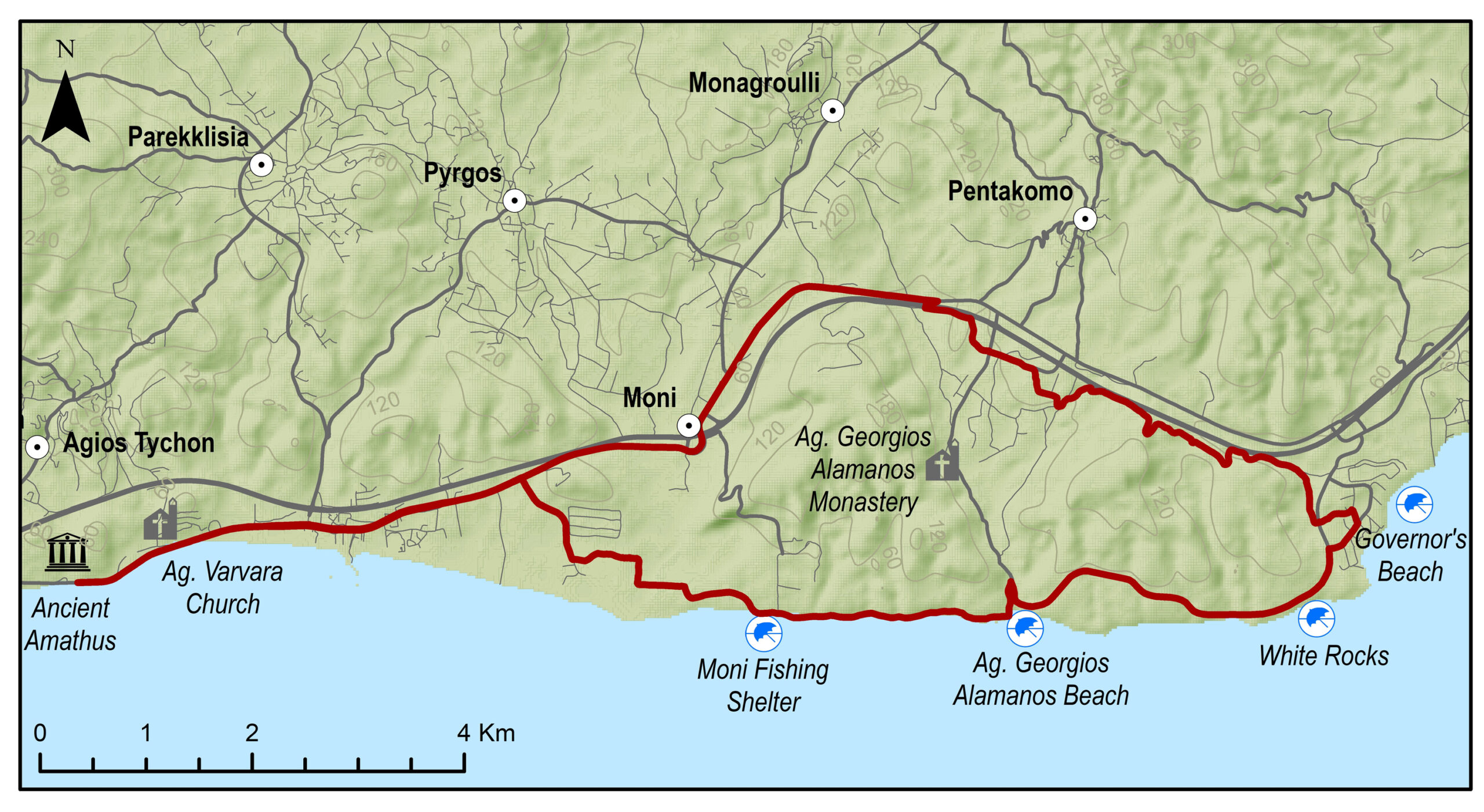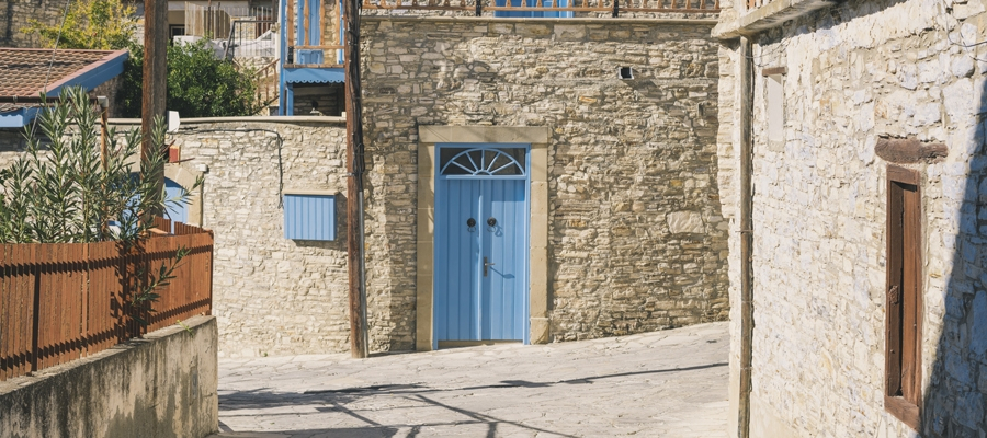
The route starts from the beautiful Tochni and heads towards the villages of Skarinou and Kofinou, before ascending to Kornos, renowned for its traditional handmade clay vessels, as well as for its tradition in beekeeping, as it produces superior quality honey. After a ride of about 20 kilometres in the mountainous Larnaka, you encounter Lefkara, known for its traditional embroidered lace and silver wire crafts. Next up is the beautiful Kato Drys, the Monastery of Agios Minas and Vavla, a designated heritage village due to its white stone houses and its traditional features. The route continues towards Choirokoitia, where the Neolithic Settlement of Choirokoitia is located, which has been registered as a UNESCO World Heritage Site since 1998, and ends in beautiful Tochni.
To download the route in gpx format click here
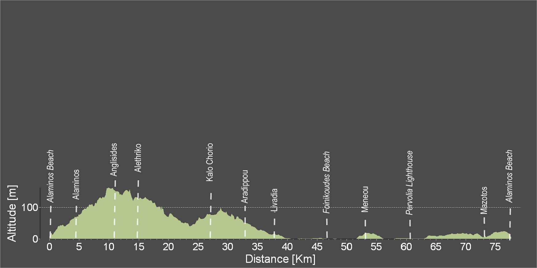
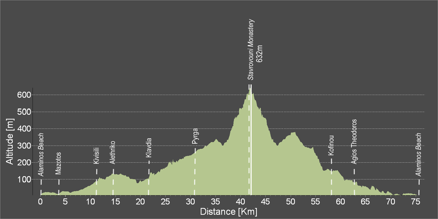
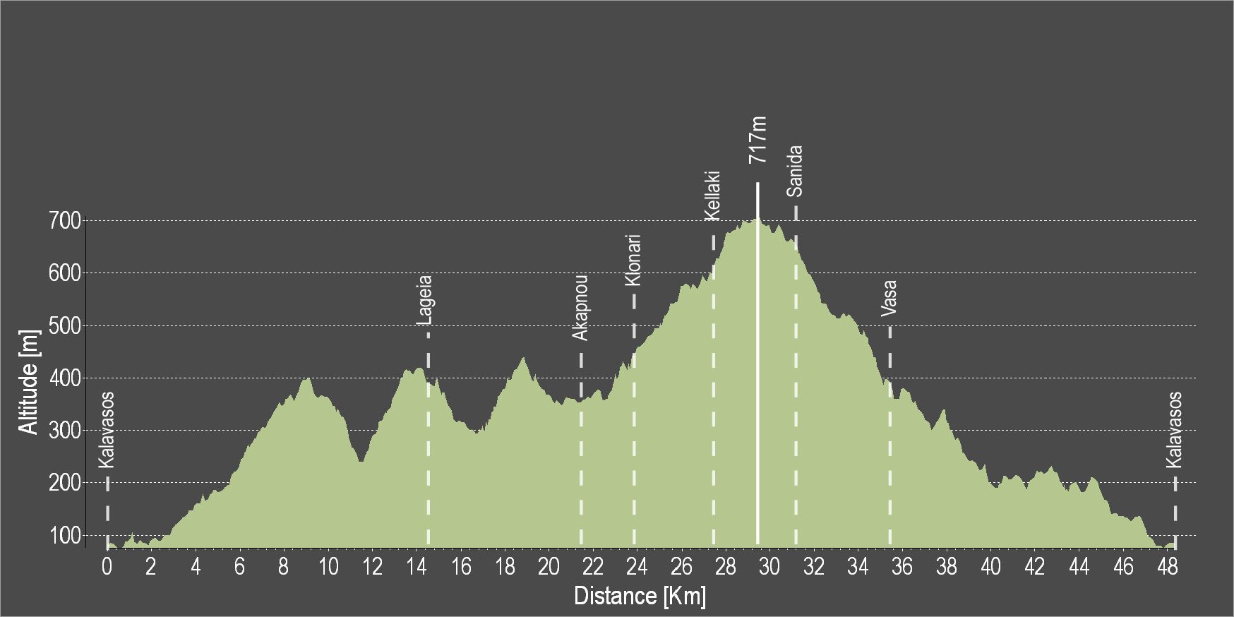
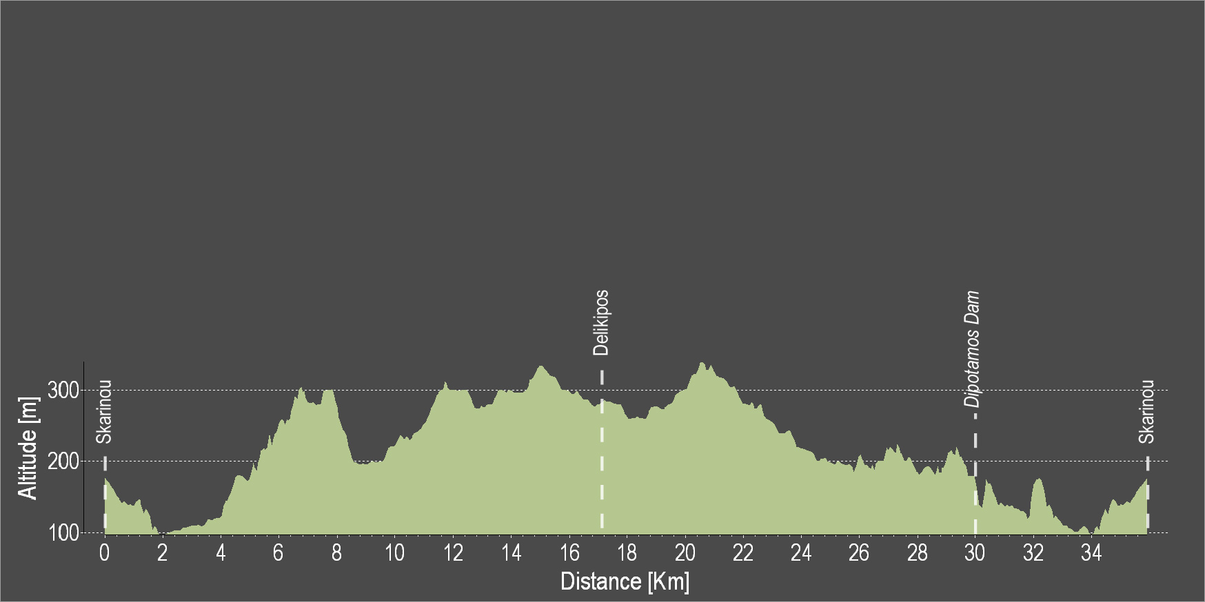
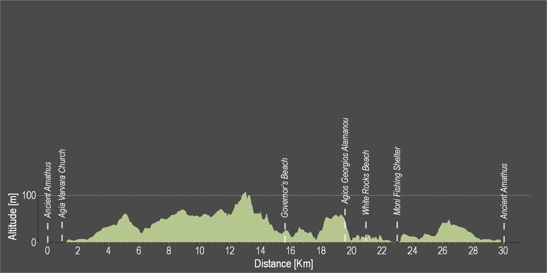
| Distance: | 81.7km |
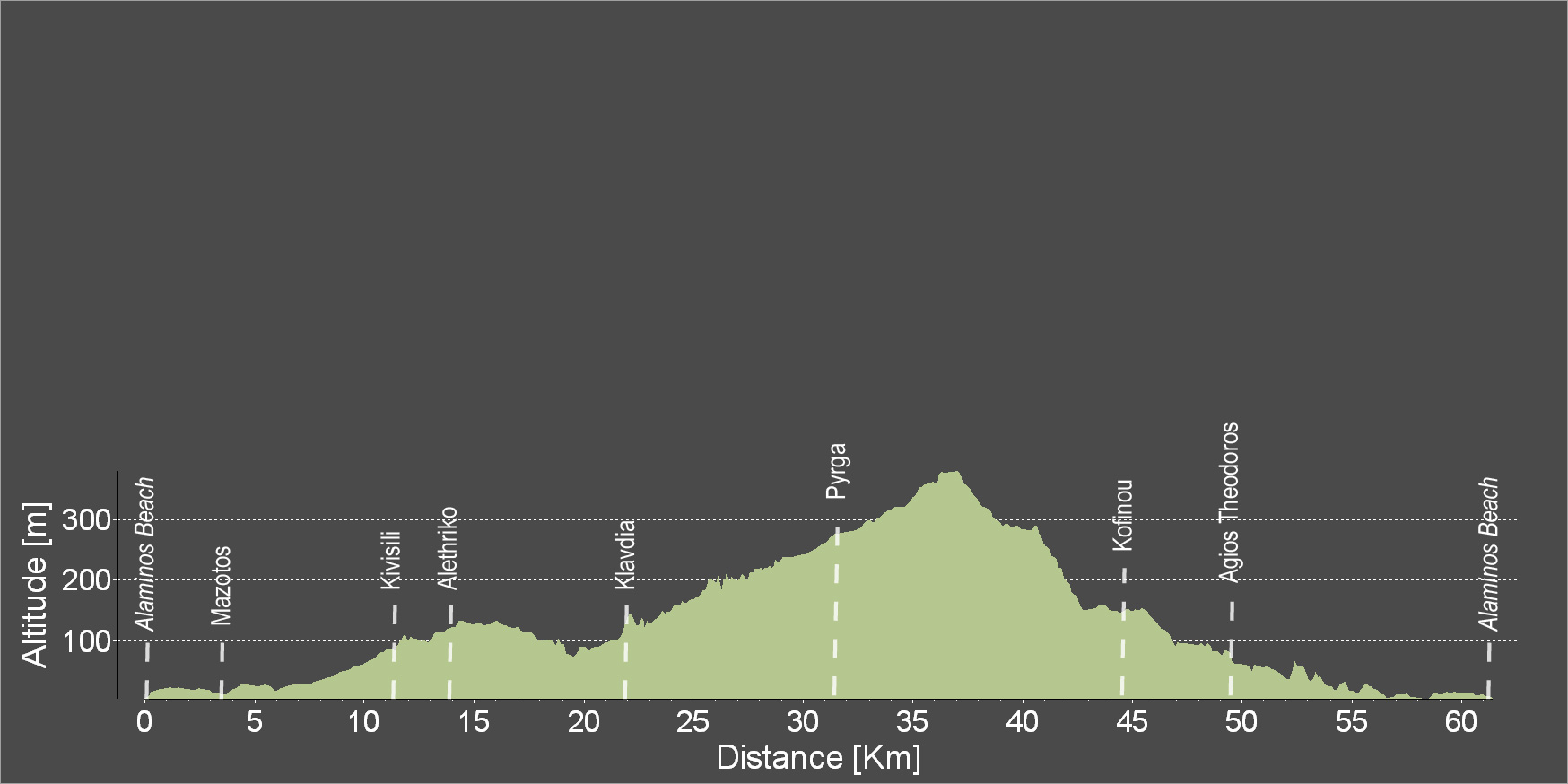
| Elevation Gain: | 1554m |
| Highest point: | 632m |
| Lowest point: | 74m |
| Loop: | YES |
| Terrain: | Mountain |
| Road surface: | Paved |
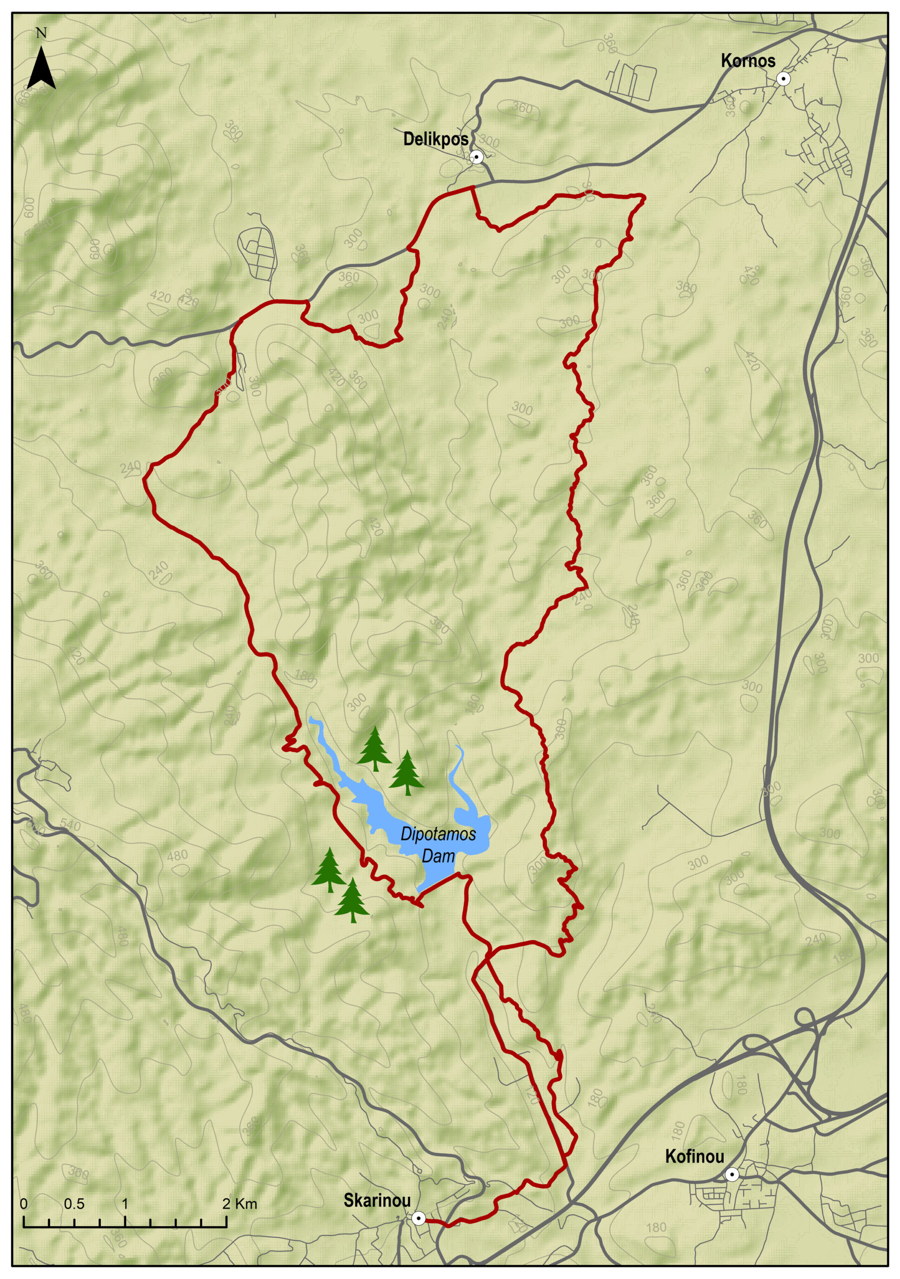
| Section Distance (km) | Total Distance (km) | |
| Tochni | 0.0 | 0.0 |
| Choirkoitia | 3.8 | 3.8 |
| Choirokoitia Neolithic Settlement | 0 | 3.8 |
| Vavla | 9 | 12.8 |
| Agios Minas Monastery | 4.1 | 16.9 |
| Kato Drys | 3.6 | 20.5 |
| Pano Lefkara | 3.2 | 23.7 |
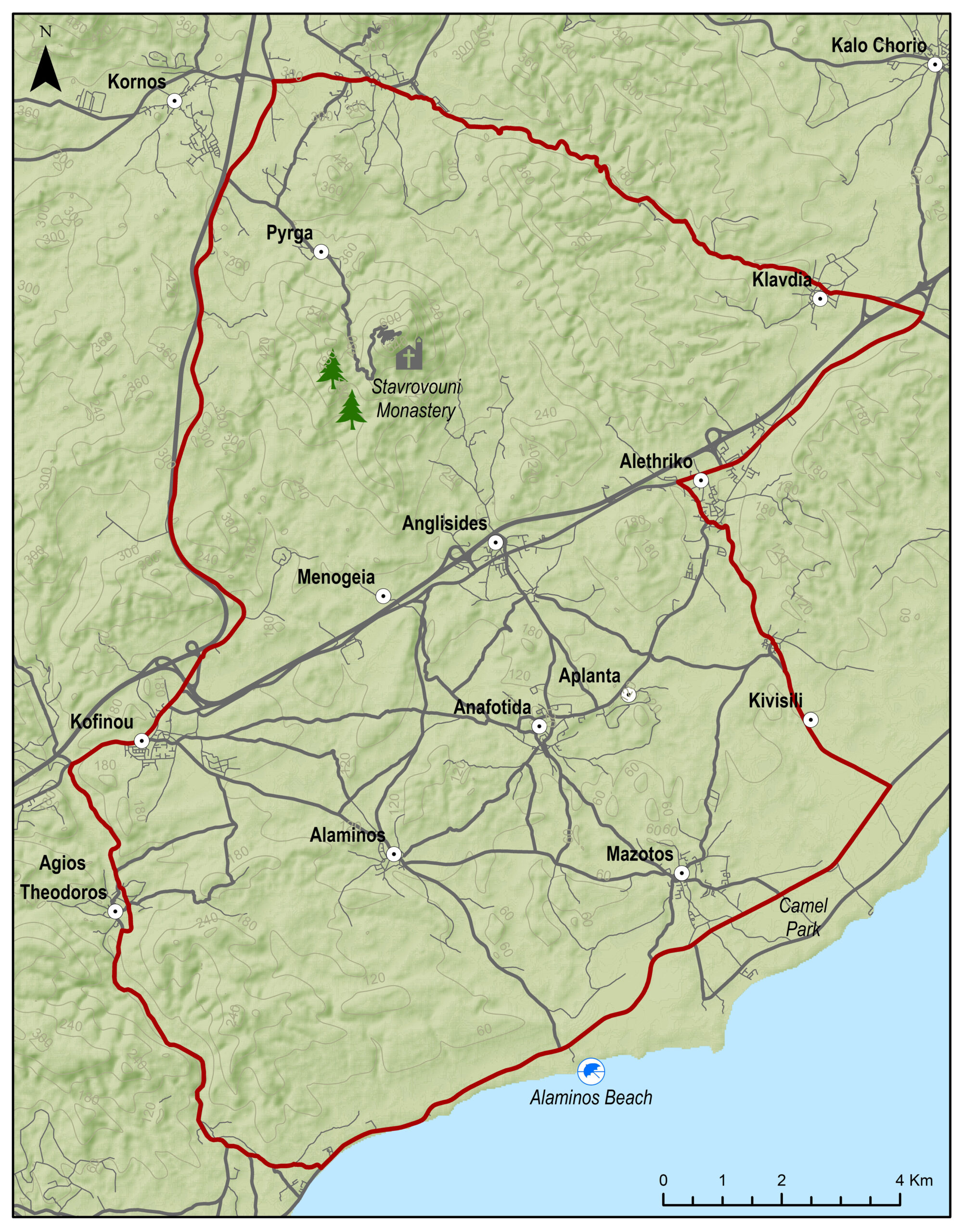
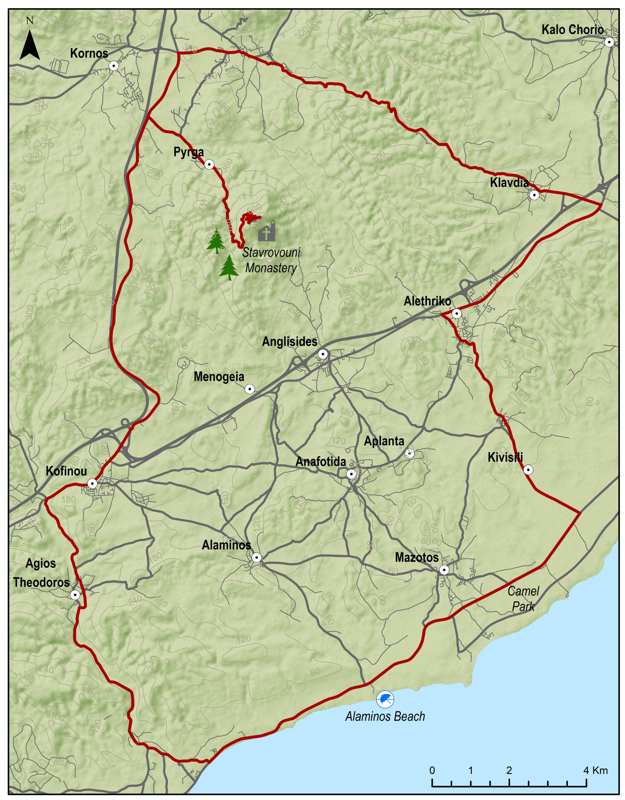
| Kornos | 16.1 | 39.8 |
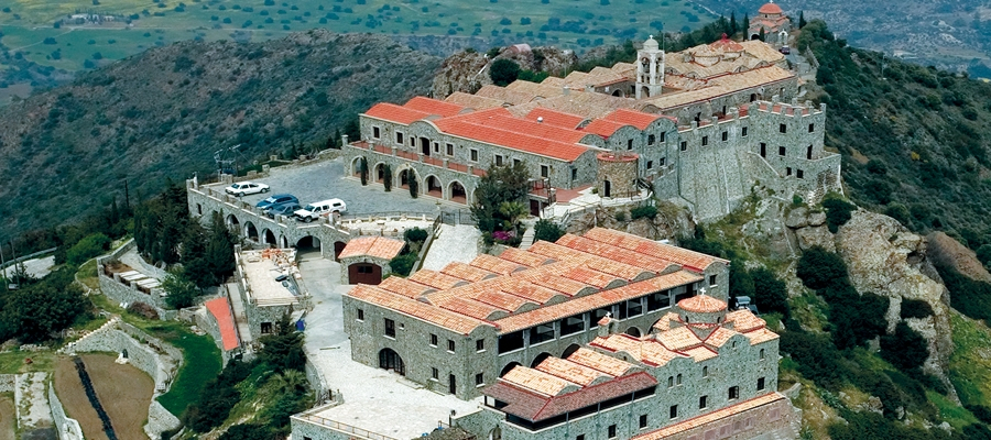
| Stavrovouni Monastery | 10.7 | 50.5 |
| Kofinou | 17.3 | 67.8 |
| Skarinou | 4 | 71.8 |
| Tochni | 9.9 | 81.7 |